


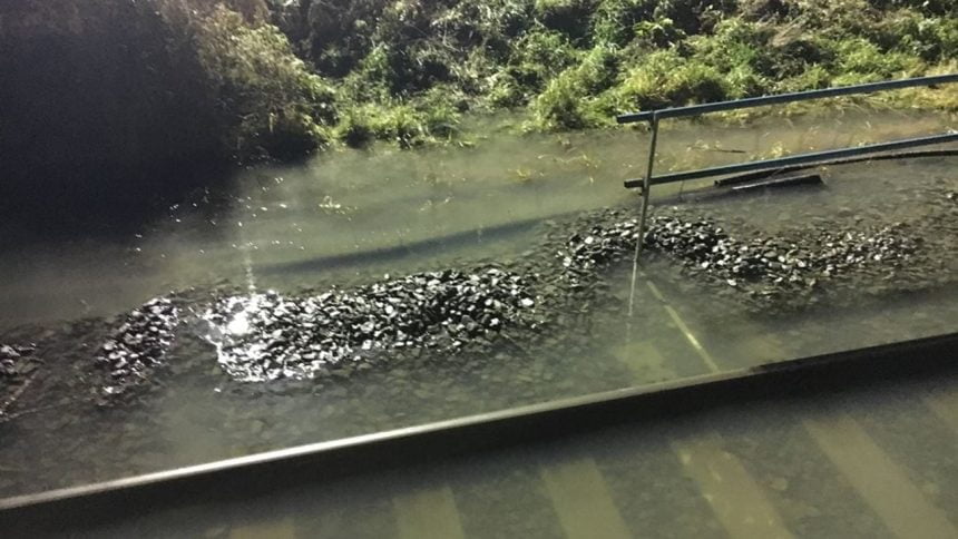
Network Rail has announced that it is planning to carry out a flood resilience project around Station Road in Hele.
Flood has been a long-term problem in the area and a scheme has been developed by Network Rail which will not only reduce the risk of flooding to the railway but also the nearby houses and businesses.
Improving the resilience the railway has against flooding will clearly mean fewer trains are cancelled in extreme weather, and it will also that if trains are cancelled, the normal service can be back up and running much quicker and improves reliability for passengers.
Subject to planning permission, the work will get underway this summer and will take about 6 months to complete.
Part of Station Road and the bridge leading to Devon Valley Mill will be replaced with new structures that will allow more water to pass through them.
The project by Network Rail will also include changing the gradient of some of the land on the approach to the level crossing – meaning better drainage.
This project is part of the Department for Transport's Flood Resilience Programme. The programme is costing around £26.5 million and was established after the extreme weather from 2012 to 2014.
Network Rail will be holding a drop-in meeting at the Crossways Tavern in Hele from 4 pm to 7 pm on 25 April to provide residents with further information on the project. Members of the project team will be on hand to answer any questions.
What did the officials say?
Victoria Bradley, Network Rail's project sponsor, said:
“This is an important project for Network Rail and along with our work at Cowley Bridge will mean less disruption for passengers in the future. In the case of Hele, our work will also have benefits for residents and local businesses.
“Subject to us gaining planning permission, there will be a six-month road closure in place to allow us to reconstruct the road and work safely, while also keeping the community and other road users safe. The diversion is expected to be around five miles in length, with a provision put in place for pedestrians.”
- Visit the Network Rail website
For more information - Visit the RailAdvent news homepage
For the latest railway news


I have no doubt the really hardened enthusiasts might inow where Hele is !!!
For those who dont its on the Taunton Exeter GWR route its a very flat river valley bordered on the south bank by the M5 and the river and fields flood like a massive resovior its only route to drain out is Southward toward cowleybridge junction which has washed away several times recently …..